11 Sep Staden
I want to understand as much as I can about the areas of Stockholm where my parents lived and worked during World War II. So I will be familiar with the names of the districts, the bridges, the main roads, the landmarks I’m going to write about different parts of town.
I know. This is pretty gutsy for someone who has never been there. Yet.
Of course, I am most interested in how things were during the war. I have two good sources from “back then.” One is “Norway, Sweden, and Denmark: Handbook for Travellers by K. Baedeker.” It was published in 1895. The binding has deteriorated so I must use it with caution, but the history portions are great. The other is “Stockholm Illustrated Guide” from 1944. Both were in my mother’s file boxes from the war years.
This is also in preparation for a trip next year, most likely in May. And yes, this week I also figured out how to install the Swedish alphabet on my laptop.
As always, I am delighted to get comments from readers with suggestions and edits.
The City of Stockholm is known as “The Venice of the North” because it is comprised of fourteen main islands on Lake Mälaren as it flows into the Baltic Sea. To the east of the city is an archipelago of twenty-four thousand islands, perhaps more, depending on the source.
According to Baedecker’s, around the year 1255 a Swede named Birger Jarl established the city when he fortified three of the islands with towers and walls in an effort to protect his dominion from invaders. From the middle of the 16th century, the citizens were able to extend their borders in peace. It’s a little confusing, but Birger is his name. Jarl is the title he was given. It translates to Earl in Swedish. According to Wikipedia, his full name was Birger Magnusson but no one calls him that because there was a King of Sweden with that same name who ruled from 1280 to 1321.
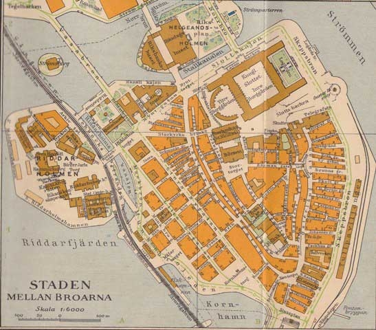
Staden (historically Stadsholmen or “Island of the City”) along with the two adjacent islets of Riddarholmen (on the western shore) and Helgeandsholmen (on the northern side) are the three islands originally occupied and are considered to be the “Old Town.”
Staden is shown as Gamla Stan (“Old Town”) on a current Google map but on the 1944 map it is shown as Staden Mellan Broarna, “The Town Between the Bridges.”
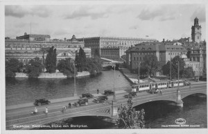
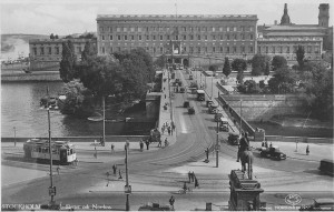
In 1944, the bridges that connected Staden to Norrmalm, the larger island to the north were the Norrbro (North Bridge—1979,) the Vasabron Bridge (1878) and Riksbron, “The National Bridge” (1931 in its current form.)
Travel south to Södermalm was accomplished on the east by way of Slussen, the traffic node created 1931-1935 (photo in 1935.) On the west was the Järnvägsbron Railway Bridge. In 1944 the Centralbron, north/south route had not been built.
In Old Town can be found the Royal Palace. In 1944 visitors could, with an admission fee, view certain suites, even the private apartments of the royal family during their absence. I am sure my mother and some of her friends from the Legation were there.
And I am sure that my Dad was in Old Town often at various government offices.
Because of Sweden’s neutrality the city of Stockholm was not bombed during the war, and much of Old Town is today similar to what it was like in 1944. The map below is from a 1944 Stockholm Guide.


Lifecruiser Travel
Posted at 17:39h, 13 SeptemberThis must be the only time in my life I feel sorry that I’m not old enough… hi hi… No, I was not there during the war – luckily. I just wanted to compliment you for your work so far -and to say that Gamla Stan really is a very lovely experience. Be sure not to miss the most narrow alley in town when you go there: Mårten Trotzig’s Gränd, which is only 90 cm on the most narrow place!